For anyone wanting to learn about Arizona and the many amazing historic and natural places to visit and enjoy - this is a blog designed for you.
Thursday, June 11, 2020
Coronado National Memorial Park
Credit: NPS
1. Along the international border between the United States and Mexico, on the southeastern slope of a sky island known as the Huachuca (Wah-choo-ka) Mountains and south of the small desert town of Sierra Vista, Arizona, the National Park System operates and oversees a unique and remote national memorial park. There are thirty national memorials across the United States and some are quite famous, like the Lincoln Memorial, Pearl Harbor Memorial and the Martin Luther King Memorial. But this Arizona high desert national memorial is dedicated to people and events that occurred some 236 years before the United States was even a country. It commemorates one of the greatest European expeditions ever to take place in the Americas - the 1540 - 1542 expedition in search of the Cibola - the fabled Seven Cities of Gold by a Spanish army led by Francisco Vásquez de Coronado.
Credit: NPS
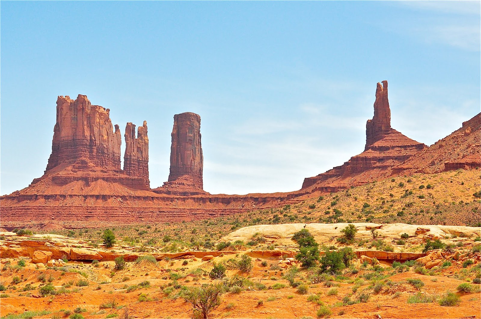
2. The Coronado National Memorial is a 4,830.22 acres (19.5472 km2) park and preserve originally established as an international park in 1939 in a hope to “advance the relationship of the United States and Mexico upon a friendly basis of cultural understanding…” to encourage the advancement of both counties common interests. The park was located here because the mountains that encompass Coronado National Memorial overlook the vast San Pedro River Valley, shown above - the valley Coronado and his men traveled when they first entered today’s United States from Mexico some 67 years before the founding of the English colony of Jamestown, VA.
Credit: University of Southern Florida
3. The story of the 1540 - 1542 Coronado’s Expedition has its genesis in the conquest of the Mexica (Aztec) people during the siege of 1519 - 1521 and led by Hernán Cortés, shown above. After the conquest, Cortés had to return to Spain to face charges of improper treatment of the Mexica people. In his absence, a new group of Spanish conquistadors, priests, soldiers and merchants arrived in the Valley of Mexico to govern and build a permanent Spanish colony in the New World.
Credit: NPS & artist José Cisneros
4. Now new men of Spain or under the ownership of Spain began to flow into what would become the modern countries of Mexico and the United States. A group of four Spanish conquistadors along with a Black, Moorish slave known in history as Esteban or Estevanico, survived a shipwreck in the Gulf of Mexico and wandered across modern Texas and the deserts of the American Southwest and Mexico between 1528 - 1536 before coming upon a group of Spanish soldiers who rescued them in northern Mexico. During their odyssey they were told of fabled Seven Cities of Gold, called Cibola, that according to the native people with whom they spoke, lay further to the north. An artist rendition of Esteban is shown above.
Credit: Linda & Dr. Dick Buscher
5. A Spanish Franciscan friar named Fray Marcos de Niza had arrived in the City of Mexico in 1531 and in 1538 agreed to accompany the Moorish slave Esteban to the unknown regions to the north in search of the Seven Cities of Gold. Historians believe that in May 1539 Esteban and Fray Marcos de Niza became the first African and first European to enter the southwest region of what would become the United States along the southern boundary of today’s Arizona. A monument to their entry is located near the small ghost mining town of Lochiel, Arizona and is shown above. The result of their journey was that Esteban was killed by the Zuni Indians in what is today’s northern New Mexico and Fray de Niza rushed back to City of Mexico and reported that he did actually did see Cibola - the Seven Cities of Gold!
Credit: NPS
6. Hernán Cortés once wrote, “We Spaniards know a sickness of the heart that only gold can cure” and Fray de Niza’s arrival back into the capital city set the hearts of this new generation of young conquistadors a blaze. A thirty year old noble, Francisco Vázquez de Coronado was selected by then Governor Antonio de Mendoza to lead a large Spanish army of soldiers and native porters to the north to claim these golden cities for the King of Spain. On February 22, 1540 Francisco Vázquez de Coronado left Compostela with a army of 336 Spanish conquistadors, 3 women and 761 Indian porters north to conquer Cibola under the banner of the Castilian flag. Coronado. Fray de Niza and a small advanced portion of his army moved north ahead of the main part of his army. This advanced group entered what is now the State of Arizona near today’s Coronado National Memorial Park along the San Pedro River Valley May 1540.
Credit: Linda & Dr. Dick Buscher
7. The two year journey of Coronado and a small part of this army into the American southwest and plains provide many “first” in the annals of American history. In the small pueblo known as Hawikuh in today’s northeastern New Mexico, the first battle between Europeans and Native Americans occurred on July 7, 1540. Since Hawikuh, shown in ruins in the above 2006 photo, was simply a small pueblo made of mud and stone and not of gold, distrust in Fray de Niza’s story of Cibola began to grow. But Coronado was now injured having received a hail of stones thrown at his head and an arrow to his leg. While recovering from his battle injuries, he ordered his officers to explore. Twenty-two year old Hernando de Alvarado the designated “Captain of the Artillery”, traveled to the northeast and while entering today’s states of Texas and Oklahoma became the first European to see and dine on the American buffalo. Captain Don García López de Cárdenas, led by a group of Hopi Indians, became the first European to gaze into the depths of the Grand Canyon.
Credit: NPS
8. Coronado would recover from his wounds. His first order of business was to send Fray Marcos de Niza back to the City of Mexico for his own safety as his men had become convinced the good Fray had lied about Cibola. But Coronado and his army of conquistodors were soon back on the trail in search of Cibola. This time they were told of a “Golden City” to the northeast known as Quivira. They began their march to Quivira on April 23, 1541. When they arrived at this pueblo, somewhere on the plains of central Kansas, they once again found only a poor village made of mud and stone. Disheartened, Coronado and his men turned their horses south and began their journey back to the City of Mexico arriving in April 1542. He was labeled a failure for not finding gold and died on September 22, 1554 never receiving the accolades for his accomplishments during his journey of exploration. And even though Coronado did not find the Seven Cities of Gold, he and his men did open the northern lands for a future generation of Spanish soldiers, priests and settlers to travel there and begin to establish permanent Spanish settlements at the beginning of the 17th Century. Some historians have argued that United States history actually began with the Coronado Expedition as he and/or his men were the first Europeans to travel through the future states of California, Arizona, New Mexico, Texas, Oklahoma and Kansas.
Credit: NPS
9. The Huachuca Mountains, home to the Coronado National Memorial Park, is one of 27 Sky Islands found in the Madera Sky Island Archipelago. It is a region of over 70,000 square miles (181,299 km²) that is the biological meeting point of two great mountain ranges - the Rocky Mountains of the north and the Sierra Madre Mountains of the south. Here over the eons of geological time the valley floors have sunk resulting in sky island mountain peaks rising to over 9,000 feet in elevation above the Sonoran Desert floor. The Huachuca Mountains, and Indian name that translates to mean “mountain of water” are within the boundary of the Coronado National Forest and the highest peak of the Huachuca Mountains rises to an elevation of 9,466 ft (2,885 m). Coronado National Memorial Park sits at the eastern end of the Huachuca Mountains and the highest peak within the park, known as Coronado Peak, rises to an elevation of 6,864 feet (2092 m).
Credit: NPS
10. Mexico was unable to ever develop their side of the intended international park. So, in July 1952 the United Staes Congress removed “international” from the park’s name and authorized designation of the park as a national Memorial. President Harry S. Truman officially designed the Coronado National Memorial Park on November 5, 1952. Finally, Coronado National Memorial Park was placed on the National Register of Historic Places on October 15, 1966. At an average elevation within the park of 4,000 feet (1,219 m), the park preserves a unique and desolate desert landscape.
Credit: NPS
11. One of the more adventurous experiences while visiting the national memorial park is a visit to Coronado Cave. A short hike brings the explorer to a 600 foot (183 m) long, 20 foot (6 m) high limestone cave. This spectacular cave, as shown above, requires no rappelling or squeezing through tight passageways but just a casual walk through rooms and areas 6 to 70 feet (2 - 21 m) wide. Old West legends suggest that native Apache Indians, including the great Chiricahua Apache shaman, Geronimo, often camped and hid out in Coronado Cave during the Apache Wars of 1849 - 1886.
Credit: NPS
12. Within the boundary of the Coronado National Memorial a vast and diverse community of desert plants thrive. Emory oaks and Gambel oak trees dominate a large part of the park. Scrubland vegetation as well as non-native grasslands dominate parts of the lower elevations of the land. Various yucca plants, like those shown above, and other high Sonoran Desert vegetation species are also common within the park. In such a rugged and isolated region, 36 species of reptiles, 7 species of amphibians, 170 species of birds and 44 species of mammals are all found at Coronado National Memorial Park.
Credit: NPS
13. Coronado National Memorial Park commemorates one of the greatest explorations ever to occur on the North American continent. The San Pedro River Valley was one of the super highways of the 1540s and Francisco Vázquez de Coronado and his men used in in search of gold. The memorial park is not highly visited, receiving some 5.5 million fewer visitors than the Grand Canyon. But for those who choose to come, they will be rewarded with a peaceful adventure in one of the most desolate yet beautiful desert parks in America.
More information - https://www.americansouthwest.net/arizona/coronado/national_memorial.html
Thursday, May 28, 2020
Pipe Spring National Monument
Credit: Linda & Dr. Dick Buscher
1. The Arizona Strip is a desolate and vast region of northern Arizona consisting of nearly 3 million acres (1,214,057 ha) that is separated from the rest of Arizona by the magnificent Grand Canyon. The strip stretches for more than 7,800 square miles (20,202 km²) from the southern Utah border to the 277 miles (446 km) length of the northern rim of the Grand Canyon. For early travelers, the difficulty in crossing the Grand Canyon resulted in the strip being isolated from the rest of Arizona while taking on cultural traditions and norms more closely associated with the settlement of Utah. Yet, this barren and remote land has long played an important and critical role in the history of this part of America.
Credit: NPS
2. Native Americans have long made this arid land their homes. Ancient Puebloans were the first to live and prosper in the region with archeological artifacts found here dating back over 8,000 years. The Southern Paiute people have claimed this high desert land as a part of their homeland since 1100. They dug small irrigation ditches in the desert soil to bring the water from desert springs into their fields of squash, sunflowers, pumpkin and corn. NPS photo above was taken in 1878 and shows three Southern Paiute girls carrying baskets sealed with pine pitch.
Credit: NPS
3. The first Europeans to pass through the Arizona Strip were a party lead by Spanish missionary Father Silvestre Vélez de Escalante. Spanish conquistadors and priests had visited the South Rim of the Grand Canyon in 1540 as a part of the Coronado Expedition but Father Escalante and his party first viewed the Grand Canyon from the North Rim in 1776. In 1829, Spanish merchant Antonio Armijo, shown above, arrived in this land hoping to establish a trade route from Santa Fe, New Mexico to Los Angeles, California. Toward the north central region of the Arizona Strip just south of what today is the Utah/Arizona border, he came upon a series of springs that brought fresh water to the surface of the desert land. Armijo documented the springs and continued his trailblazing of the Old Spanish Trail.
Credit: NPS
4. From 1830 to the mid-1850s, the Old Spanish Trail saw extensive use by pack trains carrying goods and people over the 700 mile (1,100 km) long trail. It was considered one of the most difficult of all trade-route trails ever established in the United States. One sad chapter of that trade was the opening of slave trade market by the Spanish merchants, capturing and removing Paiute women and children from their Arizona Strip homes. Soon raiding Navajos and Utes began working for the Spanish, capturing and selling the Paiute women and children. As a result, the Paiute people moved away from the springs of water first documented by Armijo that had long been a Paiute homesite to protect their women and children. Archeologists believe that the Southern Paiutes Kaibab band had a population of about 5,500 individuals at the time of European arrival into the Americas in 1492. By 1860 the Southern Paiute population was estimated to be as few as 200 individuals.
Credit: Washington County Historical Society
5. Mormon pioneers began exploring and moving into the Arizona Strip by the late 1850s. The life-giving springs, first documented by Antonio Armijo, were rediscovered by a group of Latter-day Saint missionaries in 1858 traveling to the Hopi mesas and led by legendary Morman trailblazer Jacob Hamblin. This expedition would name the area Pipe Spring. Western lore states this name originated when William “Gunlock Bill” Haynes Hamblin, brother of Jacob Hamblin, bragged that he could shoot and hit a clay smoking pipe at a distance of 50 paces. Gunlock Bill’s aim was perfect and the site has been known as Pipe Spring ever since.
Credit: Linda & Dr. Dick Buscher
6. During the 1860s Mormon settlers brought herds of cattle to the Pipe Spring area and its reliable source of fresh water. Navajo raiders from the south began poaching the cattle and in 1872 a fort, shown above, was built over the main spring of water by the first ranch manager, Anson Perry Winsor. This location assured that the settlers who worked the ranch would have a continual source of fresh water even during a prolonged attack. The fort soon became known as Winsor Castle and became the headquarters of the areas ever expanding Mormon cattle operation. Winsor Castle also served as a way station for the many Mormon families traveling from Utah to northeastern Arizona to begin new Mormon communities.
Credit: Linda & Dr. Dick Buscher
7. Winsor Castle was never tested in battle and soon became used only as a ranch house and later as a private residence. Since Winsor Castle covers Pipe Spring itself, the fresh water from Pipe Spring runs underground through a series of pipes before an open trough carries it across one room of the castle then emerging to the outside and filling two nearby ponds. See photo above.
Credit: NPS
8. Winsor Castle, as well as later built cabins were constructed by the quarrying of red sandstone from local hillsides. Local timber was harvested from trees growing in the nearby mountains and hauled to the construction site. The castle is made up of ten rooms on two levels. In two of the wall sections, the doors and windows face inward to a central courtyard totally inclosed by a high wall. The upper walls were constructed with verandas connected together by an elevated corridor above the main gate. Gun ports were strategically built into the walls but were never used in a battle. A map of Pipe Spring is shown above.
Credit: NPS
9. As Mormon settlement increased throughout southern Utah and the Arizona Strip the need to communicate with these distant settlements became a great concern for church leaders in Salt Lake City, Utah. In 1871 the Deseret Telegraph Company set the poles and strung the necessary wire across this high desert landscape to Pipe Spring establishing the first telegraph station in the Territory of Arizona. Eliza Luella Stewart, age 16, became the first telegraph operator at Pipe Spring. During the telegraph’s years of operation from 1871 - 1888, seven other women served as the Pipe Spring telegraph operator.
Credit: Linda & Dr. Dick Buscher
10. The famous Honeymoon Trail is an integral part of the Pipe Spring story. Beginning in 1877, young Mormon couples living in Northern Arizona and Southwest Utah needed to travel to the Mormon Temple located in St. George, Utah to get their marriage vows sealed. The Mormon Temple in St. George was the first temple completed and dedicated west of the Mississippi River. The journey could be short or several hundred miles in length depending on where the couple lived. It could take a few days or several weeks since their horse drawn wagons could only cover about 15 miles (24 km) each day. They had to cross a desolate land with many potential hardships. Most spent many nights sleeping on the ground under a canopy of a million stars. The fresh water of Pipe Spring was a welcome rest station for these newly wed travelers. Thousands of newly married couples made this challenging journey. Shown above is a section of the Honeymoon Trail still scarred into the high desert floor on the Arizona Strip in northern Arizona.
Credit: NPS
11. In 1907 the Kaibab Paiute Indian Reservation was established. The reservation surrounded the privately owned Pipe Spring Ranch. In 1923 the ranch was purchased from the tribe. In May 1923 in President Warren G. Harding declared Pipe Spring a national monument to commemorate Western pioneer life. The National Park Service is now responsible for the maintenance of the ranch, preserving it as it once was in its heyday. The establishment of Pipe Spring National Monument was a part of a decade of development of parks and highways in southern Utah and northern Arizona to enhance the tourism business.
Credit: NPS
12. Today, Pipe Spring National Monument is composed of 40 acres (16 ha) and receives over 25,000 visitors each year. Many of those visitors stop here before continuing on to nearby Zion National Park, one of Utah’s Mighty Five national parks. But for those who take the time to take the park ranger tour, a new appreciation for and understanding of the challenges of settling and carving out a living in this remote area of the American Southwest is surely gained.
Credit: Linda & Dr. Dick Buscher
13. Pipe Spring National Monument is a wonderfully preserved settlement of the Old West. For thousands of years men and animals have come to this site to refresh in the cool waters from the underground springs. It has been and continues to be an oasis in the high desert. Late spring through early fall are the best seasons to visit and this national monument is a “must see” for all who cherish the history of the American West.
Friday, May 22, 2020
Rainbow Bridge National Monument
Credit: NPS
1. The American West is a land of spectacular landscapes and unique geological formations. Views like Oxbow Bend, shown above, from Dead Horse Point State Park near Canyonlands National Park, Utah, are easy to access by modern, paved roads. But some of The West’s most spectacular formations, require a little more effort to reach but the experience and the views are well worth the effort. One such remote vista is Rainbow Bridge National Monument along the shores of Lake Powell in the State of Utah.
Credit: Linda & Dr, Dick Buscher
2. Rainbow Bridge National Monument is small in size, only 160 square acres (65 ha) and is under the protection of the rangers of Glen Canyon National Recreation Area. Due to its remoteness, Rainbow Bridge National Monument is currently accessible only by two, 14+ mile (23 km) hiking trails leading from Navajo Mountain or a two-hour boat ride from one of three marinas located on Lake Powell and then a 1.5 mile (2.4 km) hike. The natural rock bridge rises 290 feet (88 m) above Bridge Creek and has a span over Bridge Creek of 275 feet (84 m). The top of the arch is 42 feet (13 m) thick and 33 feet (10 m) wide.
Credit: USGS
3. Rainbow Bridge National Monument is located in the Four Corners area on the massive Colorado Plateau, a 240,000 square mile (386,242 sq km) region of spectacular geological formations and natural beauty. It is hidden away in Bridge Canyon, one of the many isolated canyons at the base of Navajo Mountain and one of nearly 100 named canyons that surround Lake Powell. Long known by Native American tribes, Rainbow Bridge is called by the Navajo People Nonnezoshe, which translates to means “rainbow turned to stone.”
Credit: NPS
4. The genesis of Rainbow Bridge began in the late Triassic Period and continues through the Jurassic Period between 187 sf 200 million years ago. During this span of time the whole Colorado Plateau region alternated between shallow seas and desert regions similar to today’s Sahara Desert. This ebb and flow of water resulted in the grains of ancient sand dunes being dispersed into thick layers of sediment ultimately forming sandstone with different degrees of hardness. Modern geologist acknowledge that Rainbow Bridge is made up entirely of Navajo Sandstone which overlies the thick layers of sandstone, shale and limestone known as the Kayenta Formation which is exposed underneath the bridge.
Credit: NPS
5. During the last great ice age, multiple regional creeks flowed from the surrounding mountains, seeking their way to the ancestral Colorado River. Bridge Creek was one such stream. Its waters slowly carved through the softer rocks flowing away from the harder Navajo Sandstone of Rainbow Bridge. These waters created a wide, hairpin curve that flowed around the solid geological fin of sandstone ( see picture above). But running water is a constant abrasive upon rock and over time, the sediment in Bridge Creek broke away the softer layers of sandstone while leaving the harder layers of Navajo Sandstone behind in the shape of Rainbow Bridge.
Credit: NPS
6. In the world of geology, a natural bridge differs from a natural arch by the way it is formed. Natural bridges, like Rainbow Bridge, are created by the erosive forces of flowing water and span ravines and/or valleys. Arches, like those commonly found at Arches National Park, do not span ravines and/or valleys and are formed by the forces of weathering and rockfalls along fractures and joints.
Credit: NPS
7. Diversity is the usual description for the plants and animals that are found in and round Rainbow Bridge National Monument. Grassland and shrubland are the two dominate plant communities found within the monument. In addition some 7 species of amphibians, 311 species of birds, 27 species of fish, 64 species of mammals and 28 species of reptiles can be found within the monuments boundary. Life giving fresh water is provided not only by Lake Powell but also by Bridge Creek, shown above, which is one of several local creeks that drain the rain and snow that fall upon Navajo Mountain.
Credit: NPS
8. A unique plant community found along the trail leading to Rainbow Bridge is that known as a hanging garden. Hanging gardens are surprisingly common in the canyons of the Colorado Plateau. The hanging garden of Rainbow Bridge is composed of a diverse water loving plants such as orchids, lilies, sedges and ferns. The hanging garden is teeming with life as upwards to 35 species of endemic plants as well as terrestrial and aquatic invertebrates, birds, mammals and amphibians all take advantage of the seeping water from the sandstone rock to carrying on their life activities. Shown above are species of Helleborine orchids and maidenhair ferns, both found in the hanging garden of Rainbow Bridge National Monument.
Credit: NPS
9. Of the 311 species of birds that visit the national monument, the Southwestern Willow Catcher, Empidonax traillii extimus, shown above, is one of the more interesting. Placed on the Endangered Species list in 1995, these little flycatchers have a large impart on a regions insect population. It commonly nests within arid region riparian areas, taking advantage of all the insect life that comes to the fresh water. Southwestern Willow Catchers are insectivores dining on a variety of both flying and terrestrial insects such as gnats, flies, beetles, butterflies and caterpillars. They employ a “sit and wait” strategy, locating their prey by sight before speeding out to capture it. Loss of habitat, livestock grazing and invasive species all pose a threat to their survival as a species.
Credit: NPS
10. Kangaroo rats, Microdipodops pallidus, shown above, are a common mammal found within Rainbow Bridge National Monument. With their long tails, big four-toed hind feet, small ears and big brown eyes, they are perfectly adapted to this high desert region. Even though plenty of fresh water is available here, kangaroo rats have evolved to surviving without drinking water, acquiring their needed moisture from the seeds that they eat. In some regions they are known as kangaroo mice and are represented by some 23 different species within their family classification. They have excellent hearing even appearing to be able to hear the muffled sound of an approaching owl. Their large back legs can propel them upwards to 9 feet (2.75m) when startled and escaping a predator.
Credit: NPS
11. Rainbow Bridge has a long tradition in the history of the Native American people who have long called these desert lands their home. Within the Hopi tradition, the Snake Clan People of Navajo Mountain were the first Hopi clan to arrive at the Hopi mesas in northern Arizona. The sandstone bridge is credited in Hopi legend as the a source of aboriginal knowledge. The region of Rainbow Bridge was a sanctuary for the Hopi people during the Great Pueblo Revolt of 1680. Within the Navajo tradition, Rainbow Bridge plays an integral part of their origin story which explains their emergence into this world. Rainbow Bridge is also the place for the Navajo people where Monster Slayer and Born for Water return to the sacred Navajo land after their journey to Father Sun.
Credit: Linda & Dr, Dick Buscher
12. At times since the completing of Glen Canyon Dam in 1963, the waters of Lake Powell have risen so high that they flow under Rainbow Bridge, as seen above. The last time this event occurred was in 1999 when the waters of Lake Powell rose to a level of 3,696 feet (1,127 m). The waters that backed-up under Rainbow Bridge rose to a depth of 43 feet (13 m). At such lake depth, visiting Rainbow Bridge is an easier adventure with no hiking involved. Currently, September 14, 2019, the depth of Lake Powell is at 3,617 feet (1,102 m) and is holding 4,381,991,363,935 gallons of water.
Credit: NPS
13. Like all geological formations, Rainbow Bridge will someday fall to the forces of erosion and weathering. Current National Park geologists insist that the bridge is currently strong and stable. And even though the bridge naturally expands upwards to 1 inch. (2.57 cm) in diameter due to the normal summer heat patterns, this expansion and contraction has been going on for thousands of years and will likely continue to do so. Rainbow Bridge is just another of the many amazing natural wonders located on the Colorado Plateau. For all who love to marvel at the spectacle of natural creation, it is an awesome place to experience.
Monday, April 20, 2020
Another Magnificent Arizona Gift
Credit: Arizona Game & Fish
I have always felt that I was incredibly fortunate to live my adult life in the Sonoran Desert with its spectacular landscapes, its vast varieties of unique plants and animals and its endless display of soul touching sunsets. And after almost 50 years of calling the magnificent desert home, to see for the first time bald eagles nesting in a saguaro is just the ultimate gift from our desert. The story of their discovery recently showed up in the Arizona Republic. We have copied that their story here... Enjoy this rare and special gift of the Sonoran Desert.
Erin Stone, Arizona Republic Published 4:46 p.m. MT April 16, 2020
A bald eagle nest in a saguaro cactus, the first time such a scene has ever been documented. (Photo: Arizona Game and Fish Department)
When Kenneth “Tuk” Jacobson got a call about a bald eagle nesting in a saguaro cactus, he had his doubts.
For one, as Arizona Game and Fish Department’s raptor management coordinator, he often received calls from the public about strange nesting situations. They were usually inaccurate.
Secondly, though biologists had long suspected bald eagles use saguaro cactuses as nesting sites, researchers had never documented such a sight in more than three decades of concerted research.
When Jacobson followed the tip and got on the ground at the site near a central Arizona reservoir, he saw the unprecedented scene with his own eyes. In the crook of the arms of a huge saguaro cactus, a bald eagle was perched on a sprawling nest made of sticks and other vegetation.
A few days later, he and his team did a helicopter survey to see the nest from above. They were further delighted to find that the pair of bald eagles had several eaglets in the nest — an indication of both the health of the nesting pair and bald eagle population growth as a whole.
“It was super exciting,” Jacobson said. “When people think of saguaro cactuses they think of Arizona. Then you have a bald eagle in the desert in a saguaro. I don’t know how much more Arizona you can get than that.”
Jacobson has watched the iconic birds return from near extinction throughout his nearly 20-year career as a wildlife biologist with Arizona Game and Fish.
“The bald eagle population was very small back in the 1970s — we had only 11 breeding areas, most of those on the lower Salt and Verde rivers," Jacobson said. “We’ve watched that population grow up through the entire river system to central Arizona. As this population continues to grow, we’re starting to see them in more and more areas using more and more unique substrates.”
When he started with the agency in 2002, Jacobson worked with John Koloszar, who ran the bald eagle program before him. Koloszar would often tell him to keep an eye on saguaros for signs of nesting eagles.
The imperiled raptors have made a remarkable comeback in Arizona, from fewer than a half-dozen nests in 1970 to 89 nests in 2019. For 18 years, per Koloszar’s advice, Jacobson has kept an eye out for bald eagles nesting in saguaros.
While there have been confirmed sightings of bald eagles nesting in the similarly columnar Cardon and Hecho cactuses in Mexico, biologists have been searching for a pair of bald eagles nesting in an Arizona saguaro for decades without success.
There had only been one documented case of bald eagles nesting in saguaros back in 1937, Jacobson said—and that historical record only noted empty nests with no eaglets or other indication of activity.
Though the population has rebounded, naturalists continue to protect the birds. That's why Jacobson isn't disclosing the saguaro's exact location, saying, "We want to share the news, but we don't want to attract a bunch of people and cause problems for the birds."
“When we started really looking at bald eagles in Arizona in the 1970s, we had it in the back of our minds as being possible, but as we surveyed the state for the last over 30 years, a saguaro nesting eagle was never documented or seen or identified,” Jacobson said. “I think finally seeing them nesting in a saguaro cactus is part of the story of their growth as a population as a whole. It’s a good sign.”
Tuesday, April 14, 2020
An Indepth Look at the Colorado Plateau
Credit: National Parks Service
1. The Colorado Plateau is a geological wonderland that encompasses 130,000 square miles (337,000 square kilometers) centered around the Four Corners area of the American West and within the states of Colorado, New Mexico, Arizona and Utah. It ranges in elevation from slightly over 2000 along the Colorado River in the Grand Canyon to over 12,000 feet in the Henry and La Sal Mountains of southeastern Utah. Over 90% of the plateau lands are drained by the Colorado River and its major tributaries – the Little Colorado, the San Juan and the Green Rivers.
Credit: Linda & Dr. Dick Buscher
2. This land is characterized by high mountains, rugged, eroded plateaus, river gorges, volcanic peaks, sandstone arches, spires and hoodoos and includes the splendor of the Grand Canyon. It is the most untamed landscape of the lower forty-eight states of the United States. It is home to the largest cluster of national parks (10) and national monuments (17) found anywhere in the world. Ten Native American tribes claim the Colorado Plateau as their homeland and share the arid region with a multitude of unique and scarce high desert plants and animals.
Credit: Linda & Dr. Dick Buscher
3. The Colorado Plateau is extremely old – at least 500 million years and possibly older. It is a well-defined, thick mass of continental crust that has remained intact and avoided the common rock reformation (folding and faulting). While the Western lands surrounding it were being broken and bent, stretched and uplifted, the Colorado Plateau amazingly remained unbroken.
Credit: Linda & Dr. Dick Buscher
4. The western boundary of the Colorado Plateau is marked by a large transition zone of common plateau geology and common Basin and Range Provinces. The northern boundary ends at the Uinta Mountains of Utah and the Rocky Mountains of Colorado. The Rio Grande Rift Valley of New Mexico, shown above in the Rio Grande Gorge, defines the eastern boundary and the Mogollon Rim of central and eastern Arizona marks the southern boundary. At the margins of the Colorado Plateau major ancient volcanic fields are found.
Credit: Linda & Dr. Dick Buscher
5. The Colorado Plateau has been divided into six, contrasting sections. The Datil section is located in eastern Arizona and western New Mexico and is mainly volcanic in origin. Here is found the Springerville Volcanic Field, an area of 1,158 square miles with over 400 dormant volcanic vents. The Springerville Volcanic Field, shown above, is 3rd largest volcanic field in the continental United States.
Credit: Linda & Dr. Dick Buscher
6. The Grand Canyon section is located in the southwestern and western edge of the Colorado Plateau. It is home to the magnificent Grand Canyon. Along the southeastern part of this section is found the San Francisco Volcanic Field, the largest volcanic field in the continental United States with over 600 ancient volcanic vents. The last volcanic eruption in this field occurred in CE 1064-1065 at Sunset Crater, near Flagstaff, Arizona.
Credit: Linda & Dr. Dick Buscher
7. The High Plateau section is located along the western and northwestern part of the Colorado Plateau. It is characterized by large plateaus separated by local faults. This section is home to the incredible geological formations of Zion and Bryce National Parks. Picture above shows a hiking trail passing through Bryce Canyon.
Credit: Jessi Brunson/US Fish & Wildlife Service
8. The Uinta Basin is found in the northern most part of the Colorado Plateau and is the lowest part of the great plateau. Many of the smaller tributaries of the Green River have their origin here in the Uinta Mountains. The great Spanish explorer, Father Silvestre Velez de Escalante, first visited this area in September 1776. Photo above is of the rare and endangered Barneby Ridge Cress (Lepidium barnebyanum) found only in the Uinta Basin.
Credit: Linda & Dr. Dick Buscher
9. The Canyonlands section is located in the northeastern part of the Colorado Plateau and is home to deeply cut canyons in a high desert environment. The landscape has been shaped and carved by the drainage systems of both the Green and Colorado Rivers. This is a land of spectacular vistas and home to both Canyonlands and Arches National Park. Photo is of the formation known as Double Arch found in Arches National Park, Utah.
Credit: Linda & Dr. Dick Buscher
10. The Navajo section of the Colorado Plateau is home to the Four Corners area of the American Southwest. It is the central area of the Colorado Plateau with landscapes of high plateaus separated by arid, high desert valleys. Many national monuments like Canyon de Chelley and Navajo Tribal Parks like Lake Powell and Monument Valley, shown above, are located in this dramatic section of the Colorado Plateau.
Credit: Linda & Dr. Dick Buscher
11. Because of the eroding effect of the rivers that crisscross the Colorado Plateau, the many deep canyons found here are like an open textbook of geological time. Precambrian metamorphosed gneiss and schist lie exposed at the bottom of the Grand Canyon and whose ages are thought to be over 1600 million years. The brilliant colors of the thick layers of sandstone and limestone sedimentary rocks resulted from the 380 – 145 million year old ancient seas of the Permian. Triassic and Jurassic Periods and now sit atop the many sculptured plateaus and vast plains seen today.
Credit: Linda & Dr. Dick Buscher
12. The arid climate of the Colorado Plateau is the result of a rain shadow caused by the Sierra Nevada Mountains located to the west of the plateau. Average annual precipitation of rain and snow ranges from 6 to 16 inches (15 – 40 cm). In the higher elevations more precipitation occurs and results in forests of pine, spruce and fir.
Credit: Linda & Dr. Dick Buscher
13. The Colorado Plateau is a region of great ecological diversity. From thick riparian river banks lined with forests of cottonwood trees to miles and miles of dry desert basins covered with saltbush and greasewood; from grass covered mountain meadows to ponderosa pine covered mountain peaks – all varieties of nature’s botanical species are represented in this rugged, untamed wilderness. During late spring and early summer wildflowers abound all across the plateau.
Credit: Linda & Dr. Dick Buscher
14. The wildlife of the Colorado Plateau is as diverse as the landforms, vegetation and the climate. Collared lizards, elk, rattlesnakes, cougars, bobcats, jackrabbits, mule deer and more all roam across the land seeking to survive in this harsh environment. This collared lizard, shown here, is enjoying the springtime sun at Arches National Park.
Credit: Linda Buscher
15. A vast variety of birds fill the sky over the Colorado Plateau. Stellar jays, wild turkeys, various species of hawks and falcons are found here. Many migratory songbirds move across the Colorado Plateau each spring and fall. The Colorado Plateau is once again home to California condors that now again soar above the deep chasms of the Grand Canyon thanks to the successful efforts of a condor reintroduction program near the Vermillion Cliffs of northern Arizona.
Credit: Linda & Dr. Dick Buscher
16. American author and environmentalist Edward Abbey when asked about the uniqueness of the Colorado Plateau, stated that "there is no other region on earth much like it, or even remotely like it ... this is a landscape that has to be seen to be believed, and even then, when confronted directly by the senses, it strains credulity."
Subscribe to:
Comments (Atom)


