Looking for a great place to escape the Valley's heat this summer? The X Diamond Ranch near Greer just might be your solution. Enjoy!
“Is this heaven?” the dude from Phoenix asked as he stepped out of his SUV into the cool breeze of the X Diamond Ranch. “Nah”, responds owner ‘Wink’ Crigler, “but it’s mighty close to it!”
And “close to heaven” is a pretty accurate description of this historic ranch located in beautiful South Fork Canyon near Greer, Arizona.
John and Molly Butler first came to the beautiful Greer Valley in the mid 1880s. Molly cooked and hosted thousands of guests in the Molly Butler Lodge. John added to the family income by guiding such folks as Zane Grey and Theodore Roosevelt into the backwoods of the White Mountains.
In the early 1900s John and Molly Butler moved into South Fork Canyon and established the X Diamond Ranch. The working cattle ranch is still owned and operated by their descendants who now share the ranch’s treasures with folks from around the world.
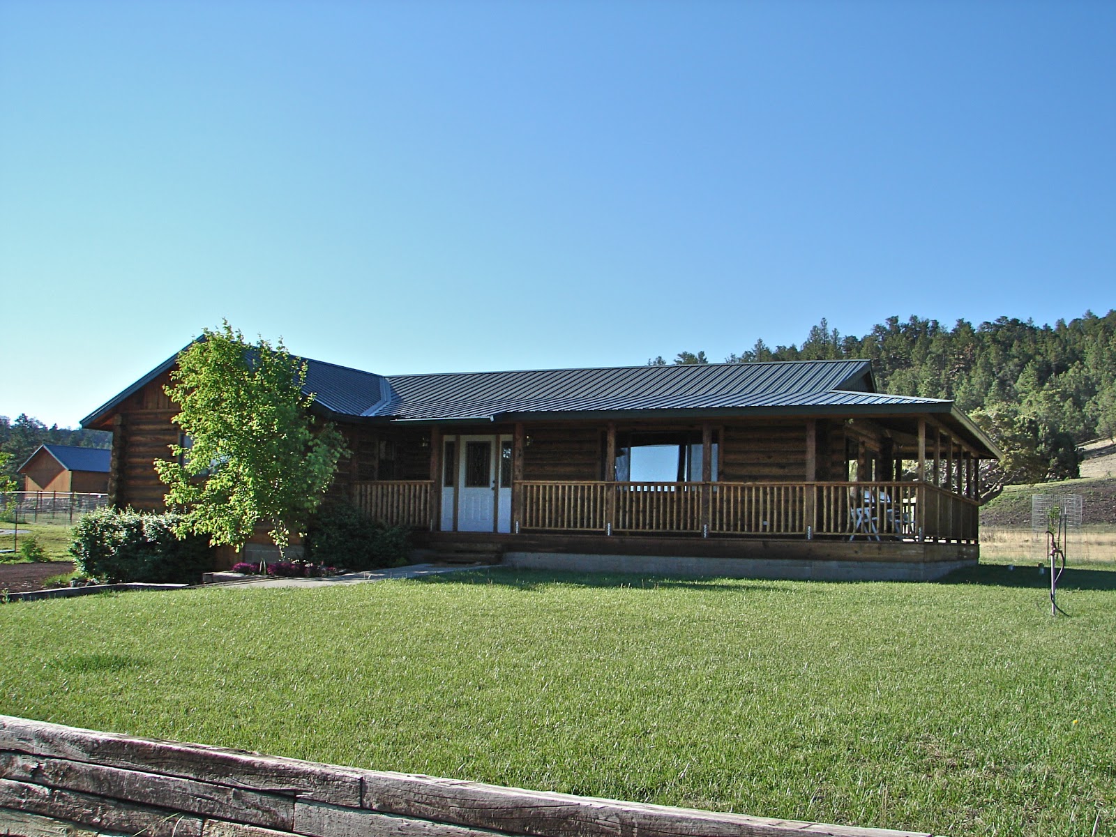
Six, rental log cabins allow visitors to spend a few days among the tall, ponderosa pines in the pristine mountain air. Ranch visitors can fly-fish for trout in Little Colorado River or horseback ride on the many canyon trails. And when you fish the streams and ride the trails of the X Diamond Ranch, you will be among some of Arizona’s most spectacular natural wonders.
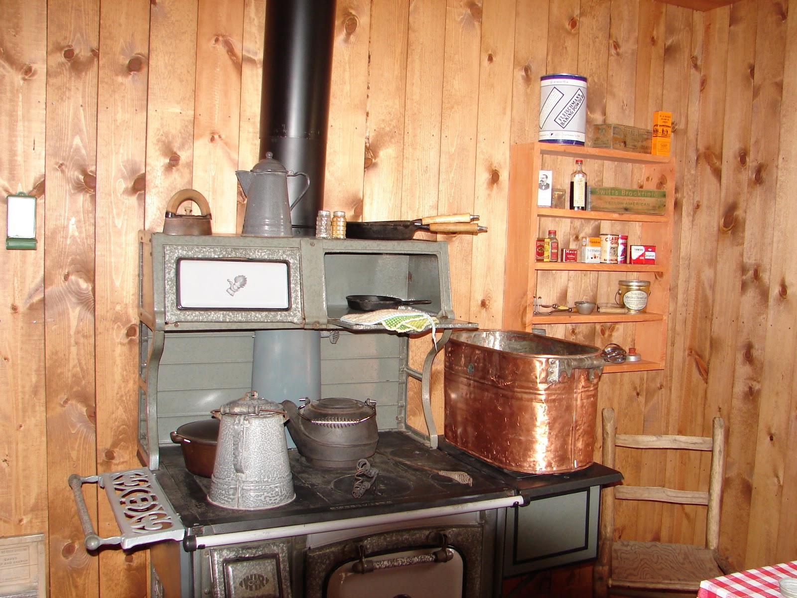
History abounds on the X Diamond Ranch. A visit to the ranch’s Little House Museum will take you back in time to the old west. Your ranch guide will share many a tale about the “pioneers, preachers and outlaws” that once called this area their home.
For those interested in Native American history, the X Diamond Ranch is the location of the Little Bear Archaeological Site. Ranch visitors can participate with the site’s archeologist in an actual scientific dig. Archaeological tours to canyon petroglyphs sites are also available.
“Is this heaven?’ Nope, but any day spent at the X Diamond Ranch will certainly be some heavenly time spent in a real, Arizona paradise.
The GPS coordinates of the X Diamond Ranch is
N 34 05.123’ W 109 25.180’. To learn more about the X Diamond Ranch, visit their web site at
www.xdiamondranch.com
For anyone wanting to learn about Arizona and the many amazing historic and natural places to visit and enjoy - this is a blog designed for you.
Thursday, May 9, 2013
Saturday, April 27, 2013
Standing On Top Of Arizona
As the Valley of the Sun approaches 100 degrees for the first time in 2013, it just might be time to begin to think about some summer escapes to cooler destinations. The ultimate summer escape has to be the 4 1/2 mile climb to the top of Humphreys Peak so you can forever brag that you too "Stood on Top of Arizona!"
The first eleven photos belong to a young man named Rob Brinkerhoff who so kindly allowed us to use his digital pictures for our In&Out story; the last 3 pictures are ours. We last climbed Humphreys Peak 23 years ago, long before any of us had ever heard of a digital camera.
This is one of the great hikes of Arizona so if it might be something you would like to do this summer, let us suggest you start planning now. Here is our story…
The first eleven photos belong to a young man named Rob Brinkerhoff who so kindly allowed us to use his digital pictures for our In&Out story; the last 3 pictures are ours. We last climbed Humphreys Peak 23 years ago, long before any of us had ever heard of a digital camera.
This is one of the great hikes of Arizona so if it might be something you would like to do this summer, let us suggest you start planning now. Here is our story…
Let
us suggest that you arise early one of these warm, summer mornings and leave
your Sonoran Desert home, traveling north on I-17 toward Flagstaff. Over the next 2 hours of time you will
travel through what zoologist Clinton Hart Merriam once suggested are 6 of the
7 lifezones found in North America.
For awakening in our low desert home to walking through the natural
biome above the Arctic Circle is possible when our goal this day is completed
by “Standing on Top of Arizona!”
Humphreys
Peak rises 12, 633 feet above sea level and is the tallest mountain in our
state that is credited with having 3,928 official mountains peaks. Located just 14 miles north of
Flagstaff in the San Francisco Mountains, this ancient volcano once again
becomes available for Arizonans to assault its summit as the winter snows melt
with the warmth of the summer sun.
Warmth
is a relative thing when one climbs to the top of Humphreys Peak. Even in the climbing months of July,
August and early September, the temperature on the summit can be in the mid-30s
and a cool wind will always be blowing.
A light jacket, stocking hat and gloves are a must along with plenty of
water and trail snacks.
The
journey to the “Top of Arizona” begins at the Arizona Snowbowl. Here is found the 9,300-foot high
trailhead for the 4.8-mile climb to the top of our beautiful
state. Some who have made this
hike contend that it is the “longest 4 1/2 mile hike in the world.”
From
the trailhead the first ¼ mile passes through a flat, open meadow full of
Alpine iris and other summer wildflowers.
Soon the adventurous hiker arrives at the edge of an old-growth forest
of Douglas and White fur, Englemann spruce, aspen and ponderosa pine
trees. The trail begins a gradual
but continual rise up through this forest and the side of the majestic mountain
with a series of long, switchbacks.
For
almost 3 miles one has walked through some of Arizona’s most beautiful
forest. At the 10,000-foot level a
massive volcanic rockslide, approximately 100 feet wide and flowing hundreds of
feet down the mountainside is found.
This ancient river of stone, frozen in time, is a graphic reminder of
this mountain’s violent origin.
Climbing
even higher, the hiker now notices that one’s breathing is a little deeper and
harder. At the 11,000-foot level,
the trees of the forest begin to disappear. Timberline is reached at 11,400 feet and the bristlecone
pine found here and above are bent and twisted into hideous shapes due to the
year long howling of the wind.
These ancient pines, considered by some as the oldest living thing on
earth, began growing on this mountain at the time the pyramids of Egypt were being constructed.
The
Humphreys Peak trail now becomes rockier and evidence of rockslides caused by
the melting snows of winter is everywhere as one climbs. Above the timberline all trees slowly
have disappeared and the only tundra found in Arizona above the 11,800-foot
level now replaces the forest.
Mt.
Agassiz is now in view and at an elevation of 12,356 feet, it is second only to
our goal in rising above Arizona.
At 11,800 feet hikers also arrive at what is known as the saddle and the
connecting ridgeline between Mts. Agassiz and Humphreys. Here too one will see for the first
time the goal, the summit of Humphreys Peak, some 870 feet higher and still
another mile away.
From
this point, the trail to the top is a series of switchbacks over basically a
cinder pile of loose talus and one’s footing could be very treacherous. In addition, the majestic mountain does
not give up its glory easily, as 3 false summits appear and pass as the weary
hiker makes the final quarter mile journey and 150 feet rise to “Stand on Top
of Arizona!”
In
our Grand Canyon State one’s legs can take them no higher than to the top of
Humphreys Peak. You are truly
standing on Arizona’s rooftop, some 2.4 miles above sea level, with a panoramic
view like no other. This is
not an easy Arizona hike and one should train well before attempting it. But if you make the effort, it will
become one of your most treasured memories of getting out and finding Arizona.
Tuesday, April 23, 2013
Zane Grey & Lovely Payson
How many of us were introduced to the American West through the novels of Zane Grey? And since Payson has made the effort to preserve some of the history of this great writer, well, Payson just became a "must visit" location for "Finding Arizona."
Payson, Arizona is the gateway city for those
escaping into the Mogollon Rim Country of Arizona. Too often travelers just pass through this mile-high
community and never stop to enjoy the historic sites found in this old, lumbering
town. One of Payson’s most famous
sites is found at Green Valley Park where the replica cabin of author Zane Grey
is located and open for the public to visit.
Zane Grey is known as the Father of the American
West. He was given that title for
writing 57 novels, 28 of whose storylines were based in Arizona. Those novels told the stories of
America’s Manifest Destiny and of the conquest and settlement of the American
West. His books would be turned
into 130 movies and 145 television episodes of Zane Grey Theater. Not only was Zane Grey the greatest of
western storytellers but also he was also a sportsman, avid adventurist and a
record-setting fisherman.
Born in Zanesville, Ohio in 1872 young Zane grew up
loving baseball, fishing and writing.
His baseball skills won him a scholarship to the University of
Pennsylvania where he studied to be a dentist.
In 1907 he traveled with to the North Rim of the
Grand Canyon to trap mountain lions.
He journaled about this adventure during his entire trip and those field
notes would become, in 1910, the bases for his first best selling book, Heritage
of the Desert. His best known
book, Riders of the Purple Sage, was published in 1912. By 1915 Zane Grey had 15 books in
print.
The success of Riders of the Purple Sage
allowed Grey to begin his own movie company which he soon sold to Jesse Lasky,
founder of Paramount Pictures.
Over the years Paramount Pictures would turn many of Zane Grey’s books
into motion pictures.
Zane Grey would become one of the world’s first millionaire
authors. His financial success
allowed him to spend a part of each year traveling and seeking more wilderness
adventurers from which he would gleam the plots and characters for another
book. He would then spend time
along the Rogue River in Oregon, living in a rustic cabin located on his
favorite mining claim or living in another of his rustic cabins near Tonto
Creek on the Mogollon Rim in what he called “my beloved Arizona.”
Grey built his Mogollon Rim haven in 1921 as a place
of solitude to escape and write.
He also loved the abundant wildlife found in the Rim Country that
allowed him to hunt and fish when taking a break from his writing. But that same passion for hunting and
fishing brought him into conflict with the Arizona Game and Fish Departments
and Zane Grey left his Arizona cabin forever in 1929.
Zane Grey’s Arizona cabin was left abandoned and
fell into disrepair. It was not
until 1962 that a Phoenix resident, Bill Goettl, who with his brother had
invented the evaporative cooler for Arizona’s desert homes, bought the Grey
cabin, rebuilt it and turned it into a popular tourist destination.
Zane Grey’s refurbished cabin would now see over
20,000 visiting tourists each year for the next 30 years. Then in 1990 the historic cabin became
one of the tragic victims of the terrible Dude Fire that roared through this
part of Rim Country consuming over 30,000 acres of pristine, ponderosa pine
forest. Many thought that the Zane
Grey story in Arizona would now be lost and forgotten in the ashes of this
tragic fire.
But even though Zane Grey’s cabin was gone, his
memory for the thousands of people who loved his novels was not. In 2003 the Zane Grey Cabin Foundation
was formed with the major goal of rebuilding a replica of Zane Grey’s Tonto
Creek cabin.
A home was found for the new cabin in Green Valley
Park near the historic district of Payson. Funds were raised and old plans were re-drawn that resulted
in the opening of the Zane Grey Cabin to visitors on October 15, 2005. Once
again those who loved the stories of Zane Grey could come to gaze at the bear
skin rug that lies in front of the petroglyph decorated fireplace mantle and
remember the man, Zane Grey, who became the Father of the American West.
Zane Grey’s cabin is operated by the Northern Gila
County Historical Society in Payson, Arizona. The society oversees both the
Zane Grey Cabin and the Rim County Museum at Green Valley Park on West Main
Street.
Tuesday, April 9, 2013
The Wonderful San Carlos Hotel
One of our favorite downtown Phoenix places; sooooo much history! Hope you enjoy our story and visit and enjoy this historic Arizona hotel real soon!
Link - http://www.hotelsancarlos.com/
On the northwest corner of Central and Monroe Streets, the Native American people of the Salt River Valley once used the land and the underground flowing water as a place to worship their god of learning. When Americans began to build their town of Phoenix, this same holy site was chosen to be the spot to build the town’s first public school building. From 1874 – 1916 the children of Phoenix came to the “Old Adobe” school to learn the lessons of those bygone days.
By 1916 the old school was in need of major repair and the land upon which is at was extremely valuable to the Phoenix business community. A new school was built on a different site and by 1919 the land at Central and Monroe sat vacant.
In the 1920s Phoenix was known as a town good for ones health and was becoming a tourist mecca. A modern hotel was desperately needed to meet the needs of visitors from around the world. Businessmen Dwight Heard and Charles Harris had the resources to finance a new hotel. Dwight Heard would become best known for the Heard Museum that was named in his honor. Charles Harris is best known in Arizona’s history as the man who designed the Arizona state flag.
Construction of the new San Carlos Hotel was begun on the spot of the old school house. When it was completed in 1927 it was the most modern hotel in the Southwest. It was the first high-rise hotel in Phoenix that was air-conditioned and its lobby and rooms were decorated “to the nines!” The twin, copper-door elevators were also the first in Phoenix and were certainly the talk of the town.
The San Carlos Hotel became the center of Phoenix social life from 1927 thru the mid 1940s. Local politicians came to unwind after a day in the legislature, businessmen cut many a deal in the Palm Room Restaurant and the Hollywood elite came to enjoy the luxurious apartments of the San Carlos. Clark Gable, Spencer Tracy, Carole Lombard, Mae West and more found their way to a weekend escape in the desert at the San Carlos!
For local Phoenicians the hotel’s French Onion Soup as known simply as the town’s best. The hotel’s dance floor was the place to be and bee seen each Saturday night. During World War II the hotel served as housing for the airmen of Luke Air Force Base.
Today the historic San Carlos Hotel remains a vital part of downtown Phoenix. The Copper Door Restaurant is the perfect place to dine before a ballgame or after an evening at the theatre. The original Austrian crystal chandeliers, sconces and mirrors still grace the restaurant and hotel lobby.
For those who would like to get out and experience Phoenix in a “gentler time”, walk through the copper-door elevators and be carried up to rooms that still retain their historic charm. As the hotel’s own website states, ‘the hotel preserves eloquent yesterdays and surges into the 21st Century.”
Link - http://www.hotelsancarlos.com/
On the northwest corner of Central and Monroe Streets, the Native American people of the Salt River Valley once used the land and the underground flowing water as a place to worship their god of learning. When Americans began to build their town of Phoenix, this same holy site was chosen to be the spot to build the town’s first public school building. From 1874 – 1916 the children of Phoenix came to the “Old Adobe” school to learn the lessons of those bygone days.
By 1916 the old school was in need of major repair and the land upon which is at was extremely valuable to the Phoenix business community. A new school was built on a different site and by 1919 the land at Central and Monroe sat vacant.
In the 1920s Phoenix was known as a town good for ones health and was becoming a tourist mecca. A modern hotel was desperately needed to meet the needs of visitors from around the world. Businessmen Dwight Heard and Charles Harris had the resources to finance a new hotel. Dwight Heard would become best known for the Heard Museum that was named in his honor. Charles Harris is best known in Arizona’s history as the man who designed the Arizona state flag.
Construction of the new San Carlos Hotel was begun on the spot of the old school house. When it was completed in 1927 it was the most modern hotel in the Southwest. It was the first high-rise hotel in Phoenix that was air-conditioned and its lobby and rooms were decorated “to the nines!” The twin, copper-door elevators were also the first in Phoenix and were certainly the talk of the town.
The San Carlos Hotel became the center of Phoenix social life from 1927 thru the mid 1940s. Local politicians came to unwind after a day in the legislature, businessmen cut many a deal in the Palm Room Restaurant and the Hollywood elite came to enjoy the luxurious apartments of the San Carlos. Clark Gable, Spencer Tracy, Carole Lombard, Mae West and more found their way to a weekend escape in the desert at the San Carlos!
For local Phoenicians the hotel’s French Onion Soup as known simply as the town’s best. The hotel’s dance floor was the place to be and bee seen each Saturday night. During World War II the hotel served as housing for the airmen of Luke Air Force Base.
Today the historic San Carlos Hotel remains a vital part of downtown Phoenix. The Copper Door Restaurant is the perfect place to dine before a ballgame or after an evening at the theatre. The original Austrian crystal chandeliers, sconces and mirrors still grace the restaurant and hotel lobby.
For those who would like to get out and experience Phoenix in a “gentler time”, walk through the copper-door elevators and be carried up to rooms that still retain their historic charm. As the hotel’s own website states, ‘the hotel preserves eloquent yesterdays and surges into the 21st Century.”
Wednesday, April 3, 2013
Arizona Canal Fun
We all know that the Salt River Project canals bring life-sustaining water to the Valley of the Sun so that 3.4 million people can call this part of the Sonoran Desert home. But, did you know that those same canals are key recreational areas? Here is our story about the Arizona Canal.
Useful links -
http://www.chelseaskitchenaz.com/
http://www.srpnet.com/water/canals/azfalls.aspx
http://www.bicyclehaus.com/
On any given day along the banks of the Arizona Canal you are able to view lots of “wildlife”. Not just the numerous ducks who make the canal their home, but also the runners, hikers and bikers that transverse it on a daily bases, wild about getting healthy. No wonder with the magnificent views of Camelback Mountain and a couple of nice watering holes along the way to wet your whistle, it’s a great way to get out and enjoy nature while getting some good exercise too.
The Arizona Canal is just one of nine Salt River Project canals that bring life-giving water to the people of the Valley of the Sun. It is the longest of the nine canals, winding some 39 miles from the Granite Reef Diversion Dam to 75th Avenue. Construction of the Arizona Canal began in 1883 making it the oldest of the Salt River Project canals.
An ideal starting point for a day journey along the Arizona Canal is the bicycle haus (sic) located at the corner of 5th Avenue and Goldwater Blvd in old, downtown Scottsdale. Public parking is available on the northwest corner. At the bicycle haus you can rent a bike by the hour/day or get a checkup on the one you brought from home. Enter the canal bank a short 25 yards from the front door and head west for a great springtime adventure.
Many new families with strollers and children in tow frequent the canal but be warned, there is no barrier between the bike path and the moving water. Safety first is always the rule when using any of the paths along the SRP canals.
First stop might be the historic Arizona Falls located just east of 56th Street and Indian School Road. The Arizona Falls is a natural 20-foot drop along the Arizona Canal. In the late 1800s Phoenicians came to the falls to picnic, socialize and dance near the cool spray of falling water. The first hydroelectric plant in Phoenix was built here in 1902 and operated until 1950.
In June 2003 a joint effort between SRP, the Phoenix Art Commission and the Arcadia neighborhood transformed the historic waterfall into a place for visitors to learn, reflect and interact. The new Arizona Falls again generates clean electricity as it combines history, art and modern technology.
Continuing to travel west soon brings the canal adventurer to the 40th Street and Camelback area. Here along the Arizona Canal is found Chelsea’s Kitchen, a wonderful place to stop for fresh squeezed lemonade, brunch or lunch.
Located in the old historic North Bank Restaurant building, Chelsea’s Kitchen is a landmark Arizona restaurant. The building features multiple fireplaces in and out with a large patio looking west, down the banks of the Arizona Canal. Children will enjoy helping a stone pooch locate his stone bone in a small pond of water at the front of the restaurant.
Bikers are now some seven miles into their journey down the Arizona Canal and this makes a good place to turn around and make ones way back to the bicycle haus. Another beautiful Arizona memory has been made along the banks of the Arizona Canal.
Useful links -
http://www.chelseaskitchenaz.com/
http://www.srpnet.com/water/canals/azfalls.aspx
http://www.bicyclehaus.com/
On any given day along the banks of the Arizona Canal you are able to view lots of “wildlife”. Not just the numerous ducks who make the canal their home, but also the runners, hikers and bikers that transverse it on a daily bases, wild about getting healthy. No wonder with the magnificent views of Camelback Mountain and a couple of nice watering holes along the way to wet your whistle, it’s a great way to get out and enjoy nature while getting some good exercise too.
The Arizona Canal is just one of nine Salt River Project canals that bring life-giving water to the people of the Valley of the Sun. It is the longest of the nine canals, winding some 39 miles from the Granite Reef Diversion Dam to 75th Avenue. Construction of the Arizona Canal began in 1883 making it the oldest of the Salt River Project canals.
An ideal starting point for a day journey along the Arizona Canal is the bicycle haus (sic) located at the corner of 5th Avenue and Goldwater Blvd in old, downtown Scottsdale. Public parking is available on the northwest corner. At the bicycle haus you can rent a bike by the hour/day or get a checkup on the one you brought from home. Enter the canal bank a short 25 yards from the front door and head west for a great springtime adventure.
Many new families with strollers and children in tow frequent the canal but be warned, there is no barrier between the bike path and the moving water. Safety first is always the rule when using any of the paths along the SRP canals.
First stop might be the historic Arizona Falls located just east of 56th Street and Indian School Road. The Arizona Falls is a natural 20-foot drop along the Arizona Canal. In the late 1800s Phoenicians came to the falls to picnic, socialize and dance near the cool spray of falling water. The first hydroelectric plant in Phoenix was built here in 1902 and operated until 1950.
In June 2003 a joint effort between SRP, the Phoenix Art Commission and the Arcadia neighborhood transformed the historic waterfall into a place for visitors to learn, reflect and interact. The new Arizona Falls again generates clean electricity as it combines history, art and modern technology.
Continuing to travel west soon brings the canal adventurer to the 40th Street and Camelback area. Here along the Arizona Canal is found Chelsea’s Kitchen, a wonderful place to stop for fresh squeezed lemonade, brunch or lunch.
Located in the old historic North Bank Restaurant building, Chelsea’s Kitchen is a landmark Arizona restaurant. The building features multiple fireplaces in and out with a large patio looking west, down the banks of the Arizona Canal. Children will enjoy helping a stone pooch locate his stone bone in a small pond of water at the front of the restaurant.
Bikers are now some seven miles into their journey down the Arizona Canal and this makes a good place to turn around and make ones way back to the bicycle haus. Another beautiful Arizona memory has been made along the banks of the Arizona Canal.
Monday, April 1, 2013
Dolly and a Tortilla Flat
There is so much to see and do before the heat of summer returns! If you want only to drive a small part of the Apache Trail (all on a paved road), let us suggest a boat ride on Dolly and lunch at Tortilla Flat. Now get out and enjoy!
Dolly link - http://www.dollysteamboat.com/
Tortilla Flat link - http://www.tortillaflataz.com/
Those still fascinated by the charms and legends of the Old West will enjoy visiting Tortilla Flat, a 100+-year-old stage stop located on the Apache Trail. Tortilla Flat is the smallest community in Arizona, boasting a population of 6. It has also been called the “friendliest little town in Arizona.”
A grassy valley with a small stream running though it, Tortilla Flat is located in the rugged Superstition Mountains. The Flat is located between two mountain ranges along a natural mountain pass. Early Native American people used this trail as they moved to and from the central mountains and the Salt River Valley. Their century old trail is known in history as the Yavapai or Tonto Trail.
It was 1904 when construction crews for Roosevelt Dam built the Apache Trail through this small, green valley. A rest stop for freight haulers on their way north to the dam site was established here and was given the name Tortilla Flat.
When Roosevelt Dam was completed in 1911, it became a major tourist attraction. Stage-riding tourists visiting the dam and mail carriers hauling the mail would spend the night at Tortilla Flat as they made their journey over the rough and dusty trail. Some 100 years later, groups of tourists still come to enjoy the adventure and enduring charm found at Tortilla Flat.
Tortilla Flat is located just 2 miles beyond Canyon Lake. Canyon Lake visitors can cruise this Salt River Lake on a replica of a classic American steam wheeler, the Dolly Steamboat. The 90 minute nature cruise is a perfect way to see the big horned sheep, mountain lion and golden eagles that make their home along the lake’s mountainous shoreline.
Once the nature cruise on Dolly Steamboat is over, it is on to Tortilla Flat for the “biggest burgers with the hottest chili” in the family friendly Superstition Saloon. Here real saddles are used for bar stools and the wallpaper is composed of dollar bills stapled to the walls over the years by the thousands of Flat visitors.
After eating, a quick visit to the Tortilla Flat Museum, which once served as the community’s school house, will bring the visitor the amazing story of the Apache Trail. Theodore Roosevelt came by here in 1911; Tom Mix made movies nearby in 1920; Wilbur Wright flew his airplane over the Flats in 1916 and Glen Ford starred here in the movie “Lust for Gold”.
Bring along a few letters and cards for those special people back east and drop them in the town’s mail box. When they are delivered the cancellation stamp will announce “Tortilla Flat, Arizona”. A quick trip to the Country Store for a scoop of Prickly Pear ice cream will bring to an end a perfect day in “the friendliest town in Arizona”, Tortilla Flat.
Dolly link - http://www.dollysteamboat.com/
Tortilla Flat link - http://www.tortillaflataz.com/
Those still fascinated by the charms and legends of the Old West will enjoy visiting Tortilla Flat, a 100+-year-old stage stop located on the Apache Trail. Tortilla Flat is the smallest community in Arizona, boasting a population of 6. It has also been called the “friendliest little town in Arizona.”
A grassy valley with a small stream running though it, Tortilla Flat is located in the rugged Superstition Mountains. The Flat is located between two mountain ranges along a natural mountain pass. Early Native American people used this trail as they moved to and from the central mountains and the Salt River Valley. Their century old trail is known in history as the Yavapai or Tonto Trail.
It was 1904 when construction crews for Roosevelt Dam built the Apache Trail through this small, green valley. A rest stop for freight haulers on their way north to the dam site was established here and was given the name Tortilla Flat.
When Roosevelt Dam was completed in 1911, it became a major tourist attraction. Stage-riding tourists visiting the dam and mail carriers hauling the mail would spend the night at Tortilla Flat as they made their journey over the rough and dusty trail. Some 100 years later, groups of tourists still come to enjoy the adventure and enduring charm found at Tortilla Flat.
Tortilla Flat is located just 2 miles beyond Canyon Lake. Canyon Lake visitors can cruise this Salt River Lake on a replica of a classic American steam wheeler, the Dolly Steamboat. The 90 minute nature cruise is a perfect way to see the big horned sheep, mountain lion and golden eagles that make their home along the lake’s mountainous shoreline.
Once the nature cruise on Dolly Steamboat is over, it is on to Tortilla Flat for the “biggest burgers with the hottest chili” in the family friendly Superstition Saloon. Here real saddles are used for bar stools and the wallpaper is composed of dollar bills stapled to the walls over the years by the thousands of Flat visitors.
After eating, a quick visit to the Tortilla Flat Museum, which once served as the community’s school house, will bring the visitor the amazing story of the Apache Trail. Theodore Roosevelt came by here in 1911; Tom Mix made movies nearby in 1920; Wilbur Wright flew his airplane over the Flats in 1916 and Glen Ford starred here in the movie “Lust for Gold”.
Bring along a few letters and cards for those special people back east and drop them in the town’s mail box. When they are delivered the cancellation stamp will announce “Tortilla Flat, Arizona”. A quick trip to the Country Store for a scoop of Prickly Pear ice cream will bring to an end a perfect day in “the friendliest town in Arizona”, Tortilla Flat.
Subscribe to:
Posts (Atom)